El Niño & La Niña around the world
Simple maps
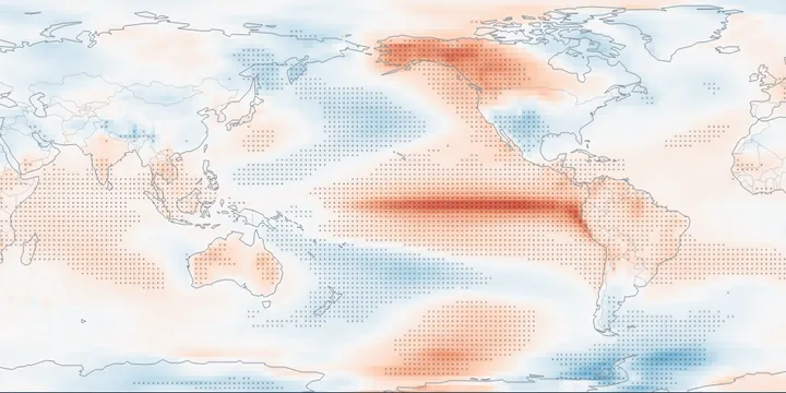
Correlations
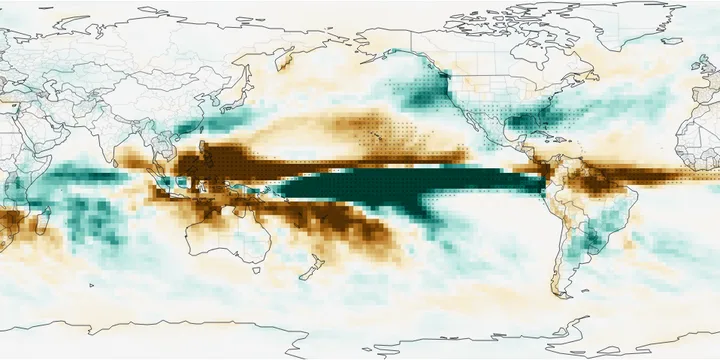
What are El Niño and La Niña?
The warm and cool phases of a natural cycle in the tropical Pacific Ocean, the El Niño–Southern Oscillation (ENSO). Every two to seven years the central and eastern equatorial Pacific warms (El Niño) or cools (La Niña) by a degree or more for several months, usually peaking in the northern winter. That shifts the heaviest tropical rain, and with it the jet streams, so the effects reach far beyond the Pacific.
These maps show what past events did. For the event under way now, see NOAA’s ENSO discussion and seasonal outlooks.